
Category:Royal Borough of Kensington and Chelsea
Boroughs of London: City of London ·City of Westminster ·Barking and Dagenham ·Barnet ·Bexley ·Brent ·Bromley ·Camden ·Croydon ·Ealing ·Enfield ·Greenwich ·Hackney ·Hammersmith and Fulham ·Haringey ·Harrow ·Havering ·Hillingdon ·Hounslow ·Islington ·Kensington and Chelsea ·Kingston ·Lambeth ·Lewisham ·Merton ·Newham ·Redbridge ·Richmond ·Southwark ·Sutton ·Tower Hamlets ·Waltham Forest ·Wandsworth
royal borough in the London Region in England    | |||||
| Upload media | |||||
| Pronunciation audio | |||||
|---|---|---|---|---|---|
| Instance of | |||||
| Location | Greater London, London, England | ||||
| Capital | |||||
| Legislative body |
| ||||
| Executive body |
| ||||
| Head of government |
| ||||
| Inception |
| ||||
| Population |
| ||||
| Area |
| ||||
| Replaces | |||||
| official website | |||||
 | |||||
Subcategories
This category has the following 22 subcategories, out of 22 total.
A
E
F
H
P
S
Media in category "Royal Borough of Kensington and Chelsea"
The following 200 files are in this category, out of 648 total.
(previous page) (next page)- "Marjon's", Fulham Road - geograph.org.uk - 6948677.jpg 1,600 × 1,216; 423 KB
- "Tardis" Police telephone box - geograph.org.uk - 2388902.jpg 2,736 × 3,648; 2.04 MB
- "Tent in the park" pavilion by Design Museum - geograph.org.uk - 5266150.jpg 3,648 × 2,736; 3.49 MB
 'Beans' on an Indian Bean Tree, Brompton Cemetery - geograph.org.uk - 6943330.jpg 1,245 × 1,600; 654 KB
.jpg/120px-Image_taken_from_page_36_of_'Old_and_New_London,_etc'_(11191197814).jpg) Image taken from page 36 of 'Old and New London, etc' (11191197814).jpg 1,892 × 1,600; 1.19 MB
Image taken from page 36 of 'Old and New London, etc' (11191197814).jpg 1,892 × 1,600; 1.19 MB_Block_on_Oxford_Gardens,_London_-_geograph.org.uk_-_6433239.jpg/120px-1960's_(^)_Block_on_Oxford_Gardens,_London_-_geograph.org.uk_-_6433239.jpg) 1960's (^) Block on Oxford Gardens, London - geograph.org.uk - 6433239.jpg 3,264 × 2,448; 2.08 MB
1960's (^) Block on Oxford Gardens, London - geograph.org.uk - 6433239.jpg 3,264 × 2,448; 2.08 MB A broad vista - Queen's Gate - geograph.org.uk - 7509589.jpg 4,032 × 3,024; 6.07 MB
 A Dutch motor-barge at Kensal Town - geograph.org.uk - 7011475.jpg 1,600 × 1,200; 437 KB
 A3220, A4 junction - geograph.org.uk - 7483794.jpg 1,024 × 684; 124 KB
 Abingdon Villas, Kensington W8 - geograph.org.uk - 6944295.jpg 1,600 × 1,194; 370 KB
 Above the District Line - geograph.org.uk - 3638299.jpg 427 × 640; 121 KB
 Addison Crescent - geograph.org.uk - 7189664.jpg 2,047 × 1,153; 1,015 KB
 Alder on the Paddington Branch - geograph.org.uk - 3932343.jpg 2,000 × 1,568; 740 KB
 Alert by Antony Gormley - geograph.org.uk - 7509577.jpg 2,907 × 3,762; 3.85 MB
 Algae Meadow, Exhibition Road, South Kensington - geograph.org.uk - 6954308.jpg 2,592 × 1,936; 1.91 MB
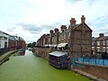
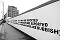 All my explanations are rubbish - geograph.org.uk - 4754734.jpg 1,600 × 1,066; 204 KB
 Alleyway to Ladbroke Grove - geograph.org.uk - 3774451.jpg 4,288 × 3,216; 4.89 MB
_in_Brompton_Cemetery_-_geograph.org.uk_-_6943332.jpg/120px-An_Indian_Bean_Tree_(Catalpa_bignonioides)_in_Brompton_Cemetery_-_geograph.org.uk_-_6943332.jpg)
 An Indian Bean Tree in Brompton Cemetery - geograph.org.uk - 6934674.jpg 1,161 × 1,600; 558 KB
 Anderson St - geograph.org.uk - 7390846.jpg 1,024 × 684; 202 KB
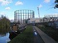 Approaching the gasworks near Kensal Green - geograph.org.uk - 4849290.jpg 1,600 × 1,200; 357 KB
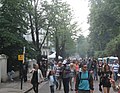 Arriving at the Carnival - geograph.org.uk - 3621519.jpg 640 × 498; 108 KB
 Artwork under Carlton Bridge - geograph.org.uk - 2421721.jpg 800 × 600; 429 KB
 Babylon Roof Gardens Restaurant - geograph.org.uk - 5244775.jpg 5,800 × 3,866; 2.53 MB
 Back of flats - geograph.org.uk - 7405891.jpg 3,200 × 2,400; 3.19 MB
 Back view of the Science Museum - geograph.org.uk - 7484580.jpg 4,032 × 3,024; 7.1 MB
 Backing onto the Grand Union Canal - geograph.org.uk - 3815756.jpg 640 × 430; 70 KB
 Backing onto the Grand Union Canal - geograph.org.uk - 3815762.jpg 640 × 430; 76 KB
 Bahrain Cultural Office, Gloucester Rd - geograph.org.uk - 7483519.jpg 1,024 × 684; 164 KB
 Bank in woodland to conserve rainwater, Holland Park - geograph.org.uk - 5807948.jpg 2,736 × 2,049; 3.26 MB
 Barge berthed near Albert Bridge - geograph.org.uk - 7299179.jpg 800 × 600; 92 KB
 Barge in Chelsea Reach - geograph.org.uk - 5375486.jpg 640 × 357; 72 KB
 Barkston Gardens, SW5 - geograph.org.uk - 6448692.jpg 1,024 × 768; 493 KB
 Basin by the Grand Union Canal - geograph.org.uk - 3815733.jpg 640 × 430; 58 KB
 Battersea Bridge Looking over at Albert Bridge - geograph.org.uk - 7249725.jpg 4,000 × 1,128; 994 KB
.jpg/120px-Bears_Den,_Tabernacle,_London_(32508141377).jpg) Bears Den, Tabernacle, London (32508141377).jpg 3,072 × 1,728; 1,017 KB
Bears Den, Tabernacle, London (32508141377).jpg 3,072 × 1,728; 1,017 KB Blossom and peacock in the Kyoto Garden - geograph.org.uk - 6131474.jpg 4,000 × 3,000; 4.78 MB
 Blue plaque and entrance to Peel Cottage - geograph.org.uk - 7405937.jpg 3,050 × 2,287; 1.26 MB
 Bluebell - narrowboat on Paddington Arm, Grand Union Canal - geograph.org.uk - 4461317.jpg 3,648 × 2,736; 3.94 MB
 Boats parked by Battersea Bridge - geograph.org.uk - 2099520.jpg 640 × 430; 119 KB
 Botanical adornment in Brompton Cemetery - geograph.org.uk - 7033640.jpg 3,660 × 4,832; 6.11 MB
 Bourne St, Whittaker St - geograph.org.uk - 7385669.jpg 1,024 × 685; 145 KB
 BP Olympics billboard - geograph.org.uk - 7072493.jpg 2,424 × 1,747; 767 KB
 Bridge 4 Paddington Arm - Ladbroke Grove west access - geograph.org.uk - 2735520.jpg 3,648 × 2,736; 2.88 MB
 Brompton , Lennox Gardens - geograph.org.uk - 6164951.jpg 994 × 1,024; 901 KB
 Builder's yard, West Kilburn - geograph.org.uk - 2421788.jpg 800 × 600; 434 KB
 Building by the Grand Union Canal - geograph.org.uk - 3815742.jpg 640 × 430; 67 KB
 Burton Court - geograph.org.uk - 7299194.jpg 800 × 600; 157 KB
 Burton Court, Royal Hospital, Chelsea - geograph.org.uk - 7233895.jpg 5,046 × 3,527; 5.09 MB
 Cadogan Pier and River Thames - geograph.org.uk - 7539244.jpg 1,024 × 683; 490 KB
 Cadogan Pier from Albert Bridge - geograph.org.uk - 7539247.jpg 1,024 × 683; 462 KB
 Cadogan Place - geograph.org.uk - 7538913.jpg 1,024 × 683; 545 KB
 Cadogan Place Gardens - geograph.org.uk - 7538905.jpg 1,024 × 683; 729 KB
 Campden Houses No.2 - geograph.org.uk - 5530345.jpg 425 × 640; 87 KB
 Campden Houses No.3 - geograph.org.uk - 5530342.jpg 426 × 640; 83 KB
 Campden Houses No.5 - geograph.org.uk - 5530347.jpg 425 × 640; 85 KB
 Campden Houses No.6 - geograph.org.uk - 5530352.jpg 426 × 640; 84 KB
 Campden Houses No.7 - geograph.org.uk - 5530357.jpg 425 × 640; 84 KB
 Canal boat on The Grand Union Canal - geograph.org.uk - 6385221.jpg 5,456 × 3,632; 4.02 MB
 Canal bridge at Kensal Green - geograph.org.uk - 2387603.jpg 1,024 × 768; 384 KB
 Canalside Apartments - geograph.org.uk - 3953466.jpg 3,744 × 2,460; 3.12 MB
 Canalside properties at Kensal Town - geograph.org.uk - 4849299.jpg 1,600 × 1,200; 327 KB
 Carlyle Square Gardens - geograph.org.uk - 7180935.jpg 2,048 × 1,536; 1.37 MB
 Caroline on the Paddington Branch - geograph.org.uk - 3932247.jpg 2,000 × 1,545; 708 KB
 Central courtyard of the Victoria ^ Albert Museum - geograph.org.uk - 6853427.jpg 2,592 × 1,936; 2.24 MB
 Chapel of Assumption - geograph.org.uk - 7483740.jpg 685 × 1,024; 167 KB
 Charles Darwin Statue, Natural History Museum - geograph.org.uk - 7545714.jpg 1,339 × 2,000; 1.09 MB
 Cheese stall, Chelsea - geograph.org.uk - 3772050.jpg 4,663 × 3,320; 6.11 MB
 Chelsea , Donne Place - geograph.org.uk - 6163757.jpg 829 × 1,024; 602 KB
 Chelsea , Sutton Dwellings - geograph.org.uk - 6164358.jpg 776 × 1,024; 826 KB
 Chelsea , Sutton Dwellings - geograph.org.uk - 6164368.jpg 881 × 1,024; 818 KB
 Chelsea , Sutton Dwellings - geograph.org.uk - 6164374.jpg 779 × 1,024; 524 KB
 Chelsea , Walton House - geograph.org.uk - 6164313.jpg 789 × 1,024; 992 KB
 Chelsea , Walton House - geograph.org.uk - 6164329.jpg 652 × 1,024; 620 KB
 Chelsea - geograph.org.uk - 7388842.jpg 3,419 × 1,923; 7.76 MB
 Chelsea - geograph.org.uk - 7388843.jpg 3,536 × 2,652; 7.71 MB
 Chelsea Creek - geograph.org.uk - 5289920.jpg 640 × 426; 68 KB
 Chelsea Creek - geograph.org.uk - 5308298.jpg 1,600 × 1,200; 547 KB
 Chelsea Creek - geograph.org.uk - 6959293.jpg 640 × 303; 68 KB
 Chelsea Creek at high tide - geograph.org.uk - 6943011.jpg 1,166 × 1,600; 419 KB
 Chelsea Creek Warehouse - geograph.org.uk - 4334722.jpg 640 × 480; 38 KB
 Chelsea Embankment - geograph.org.uk - 2322527.jpg 640 × 288; 50 KB
 Chelsea Embankment - geograph.org.uk - 7539241.jpg 1,024 × 683; 620 KB
 Chelsea Embankment seen from Battersea Park - geograph.org.uk - 6352753.jpg 4,885 × 2,479; 2.71 MB
 Chelsea Flower Show - geograph.org.uk - 7168066.jpg 2,048 × 1,536; 1.19 MB
 Chelsea Gate - geograph.org.uk - 7299189.jpg 800 × 535; 89 KB
 Chelsea houseboat village - geograph.org.uk - 2873685.jpg 4,000 × 3,000; 4.19 MB
 Chelsea houseboat village - geograph.org.uk - 2873696.jpg 4,000 × 3,000; 4.12 MB
 Chelsea houseboats - geograph.org.uk - 4602937.jpg 1,024 × 683; 166 KB
 Chelsea photoshoot - geograph.org.uk - 7435816.jpg 2,913 × 1,956; 1.25 MB
 Chelsea shops - geograph.org.uk - 5663230.jpg 3,188 × 2,391; 1.34 MB
 Chelsea waterfront - geograph.org.uk - 4704491.jpg 5,841 × 3,894; 2.44 MB
 Chelsea, green - geograph.org.uk - 5087142.jpg 1,024 × 768; 315 KB
 Chelsea, moorings - geograph.org.uk - 5085597.jpg 1,024 × 740; 185 KB
 Chelsea, moorings - geograph.org.uk - 5085662.jpg 1,024 × 768; 156 KB
 Chimneys of Lots Road Power Station - geograph.org.uk - 7334442.jpg 1,024 × 684; 167 KB
 Church of St Augustine - geograph.org.uk - 7390901.jpg 1,024 × 684; 141 KB
 Church of St Augustine - geograph.org.uk - 7390904.jpg 1,024 × 684; 193 KB
 Church of St James - geograph.org.uk - 7036070.jpg 1,024 × 684; 276 KB
 Church of St Stephen - geograph.org.uk - 7483515.jpg 685 × 1,024; 174 KB
 Clanricarde Gardens - geograph.org.uk - 7036280.jpg 1,024 × 684; 254 KB
 Cliveden Place - geograph.org.uk - 4194414.jpg 640 × 430; 81 KB
 Coat of arms of the Royal Borough of Kensington and Chelsea.svg 1,121 × 977; 2.33 MB
 Collingham Place - geograph.org.uk - 7390964.jpg 1,024 × 684; 185 KB
 Colourful housing, Chelsea - geograph.org.uk - 7435817.jpg 2,687 × 4,030; 2.24 MB
 Comffortable Fitflop - geograph.org.uk - 3805682.jpg 640 × 480; 105 KB
 Coming to a point - geograph.org.uk - 2826715.jpg 1,024 × 768; 135 KB
 Comptoir Libanais - geograph.org.uk - 4516855.jpg 640 × 481; 117 KB
 Courtfield - geograph.org.uk - 7390977.jpg 1,024 × 684; 226 KB
 Cranley Gardens - geograph.org.uk - 7064146.jpg 2,195 × 1,758; 990 KB
 Crompton Court - geograph.org.uk - 7390868.jpg 1,024 × 684; 151 KB
 Cycle hire on Exhibition Road - geograph.org.uk - 7484575.jpg 4,032 × 3,024; 5.24 MB
 Cylindrical floating storage container on canal - geograph.org.uk - 5048328.jpg 2,304 × 1,728; 2.44 MB
 Decorative panel, South Kensington - geograph.org.uk - 4979909.jpg 1,616 × 1,156; 357 KB
 Department of Chemistry - Imperial College - geograph.org.uk - 7484583.jpg 4,032 × 3,024; 6.32 MB
 Detail of a Dutch motor-barge - the port lee-board - geograph.org.uk - 7011496.jpg 1,600 × 1,122; 434 KB
 Dilke Street - geograph.org.uk - 7539239.jpg 1,024 × 683; 539 KB
 Diner, Science Museum - geograph.org.uk - 7423636.jpg 4,032 × 3,024; 4 MB
 Downstream from Albert Bridge - geograph.org.uk - 7539248.jpg 1,024 × 683; 388 KB
 Earl's Court Police Box Outside Earl's Court Station - geograph.org.uk - 7489896.jpg 3,024 × 4,032; 6.88 MB
 Earls Court Gardens - geograph.org.uk - 7390967.jpg 1,024 × 684; 195 KB
 Earls Court Two - geograph.org.uk - 6448868.jpg 1,024 × 768; 408 KB
 Earls Terrace - geograph.org.uk - 7483776.jpg 685 × 1,024; 130 KB
 Edwardes Square - geograph.org.uk - 7483780.jpg 1,024 × 684; 210 KB
 Elephant, Chelsea Flower Show - geograph.org.uk - 4969736.jpg 3,000 × 4,000; 3.08 MB
 Elgin Crescent - geograph.org.uk - 7074520.jpg 838 × 809; 191 KB
 Ellesmere - narrowboat on Paddington Arm, Grand Union Canal - geograph.org.uk - 4460925.jpg 3,648 × 2,736; 3.55 MB
 Elvaston Place - geograph.org.uk - 7483686.jpg 1,024 × 685; 189 KB
 Emma Jane - narrowboat on Paddington Arm, Grand Union Canal - geograph.org.uk - 4461250.jpg 3,648 × 2,736; 3.65 MB
 Emu on the Paddington Branch - geograph.org.uk - 3932299.jpg 2,000 × 1,756; 729 KB
 Entrance to Chelsea Flower Show - geograph.org.uk - 7299199.jpg 800 × 507; 106 KB
 Evelyn Gardens - geograph.org.uk - 7064150.jpg 2,521 × 1,784; 1.02 MB
 Evelyn Gardens - geograph.org.uk - 7064153.jpg 3,372 × 2,621; 1.93 MB
 Evelyn Gardens - geograph.org.uk - 7072484.jpg 1,615 × 2,148; 555 KB
 Evelyn Gardens - geograph.org.uk - 7107643.jpg 2,869 × 4,320; 2.14 MB
 Farm Cottage - geograph.org.uk - 7405965.jpg 3,200 × 2,400; 3.06 MB
 Farm Place - geograph.org.uk - 7405957.jpg 3,200 × 2,400; 3.09 MB
 Fat squirrel posing on a gravestone - geograph.org.uk - 7033644.jpg 4,993 × 3,758; 2.65 MB
 Feeding the Squirrel, Holland Park - geograph.org.uk - 5695992.jpg 5,312 × 2,988; 5.2 MB
 Fired Earth, Notting Hill - geograph.org.uk - 4994221.jpg 640 × 480; 117 KB
 Flats by the Thames in Battersea - geograph.org.uk - 5812379.jpg 2,048 × 1,536; 1.5 MB
 Flats overlooking Grand Union Canal - geograph.org.uk - 6385167.jpg 5,456 × 3,632; 2.04 MB
 Flats reflected in the Grand Union Canal - geograph.org.uk - 3155044.jpg 1,024 × 768; 1.27 MB
 Flats, Kensal Green - geograph.org.uk - 4905716.jpg 640 × 426; 90 KB
 Flats, Kensal Town - geograph.org.uk - 4905710.jpg 640 × 426; 73 KB


 Footbridge over canal - geograph.org.uk - 4742666.jpg 640 × 480; 130 KB

 Footbridge over the Paddington Arm - geograph.org.uk - 5492913.jpg 4,000 × 3,000; 2.95 MB
 Footbridge over the Paddington Arm of the Grand Union Canal - geograph.org.uk - 3769281.jpg 4,000 × 3,000; 4.04 MB
 Former lifeboat on the Grand Union Canal - geograph.org.uk - 6385525.jpg 5,456 × 3,632; 2.76 MB
 Fountain, Holland Park Avenue - geograph.org.uk - 7036044.jpg 684 × 1,024; 272 KB

.jpeg/120px-Fötus_Siebter_Monat_(193364921).jpeg) Fötus Siebter Monat (193364921).jpeg 1,365 × 2,048; 654 KB
Fötus Siebter Monat (193364921).jpeg 1,365 × 2,048; 654 KB Garden Corner - geograph.org.uk - 5295724.jpg 454 × 640; 103 KB
 Garden of Edible and Useful Plants - geograph.org.uk - 2971849.jpg 2,272 × 1,704; 2.67 MB
 Gas holder - geograph.org.uk - 5201451.jpg 640 × 389; 65 KB
 Gasholder - geograph.org.uk - 4905626.jpg 640 × 425; 82 KB
 Gasholder - geograph.org.uk - 6786779.jpg 1,024 × 684; 183 KB
 Gasholder by the Grand Union Canal - geograph.org.uk - 3815689.jpg 640 × 430; 68 KB
 Gasholder, Kensal Gas Works - geograph.org.uk - 5594460.jpg 640 × 445; 75 KB
 Gasholder, Kensal Gasworks - geograph.org.uk - 5652445.jpg 640 × 426; 70 KB
 Gasholder, Kensal Gasworks - geograph.org.uk - 5652446.jpg 640 × 425; 70 KB
 Gasholders by the Grand Union Canal - geograph.org.uk - 3815706.jpg 640 × 430; 47 KB
 Gasometer from the train, Kensal Green - geograph.org.uk - 3529272.jpg 1,600 × 1,064; 459 KB
 Gasometers near railway lines - geograph.org.uk - 4732798.jpg 800 × 541; 116 KB
 Gasworks view - geograph.org.uk - 2268220.jpg 640 × 480; 88 KB
 Gated access - Imperial College Road - geograph.org.uk - 7509584.jpg 4,031 × 3,024; 4.01 MB
 Gates to Holland Park - geograph.org.uk - 7483766.jpg 1,024 × 684; 268 KB
 Gateways, Kensington Palace Gardens - geograph.org.uk - 7036284.jpg 1,024 × 684; 235 KB
 Gateways, Kensington Palace Gardens - geograph.org.uk - 7036285.jpg 1,024 × 684; 243 KB
 Getting lunch ready - geograph.org.uk - 3621529.jpg 640 × 480; 98 KB
 Glass dome at Chelsea Harbour - geograph.org.uk - 4220652.jpg 480 × 640; 171 KB
 Godfrey Street, Chelsea - geograph.org.uk - 7435815.jpg 5,082 × 3,140; 2.68 MB
 Greenhouses - geograph.org.uk - 3846625.jpg 640 × 478; 159 KB
 Grenville Place - geograph.org.uk - 7189647.jpg 2,047 × 1,153; 675 KB
 Half Penny Steps bridge - geograph.org.uk - 2421761.jpg 800 × 600; 394 KB
 Hansard Mews - geograph.org.uk - 7089232.jpg 2,577 × 4,063; 2.55 MB
 Harriet Walk, SW1, looking south - geograph.org.uk - 6381090.jpg 1,024 × 768; 282 KB
 Henley - narrowboat on Paddington Arm, Grand Union Canal - geograph.org.uk - 4450764.jpg 3,648 × 2,736; 3.89 MB
 High Fashion - geograph.org.uk - 5303412.jpg 3,264 × 4,896; 2.98 MB
 High-rise blocks, from the West London Line - geograph.org.uk - 2830557.jpg 1,024 × 768; 97 KB
 Hire bikes in docks on Addison Road - geograph.org.uk - 7506438.jpg 1,600 × 1,200; 837 KB
 Holbein Place - geograph.org.uk - 7385670.jpg 1,024 × 685; 204 KB


.jpg)
_Block_on_Oxford_Gardens,_London_-_geograph.org.uk_-_6433239.jpg)


_in_Brompton_Cemetery_-_geograph.org.uk_-_6943332.jpg)


.jpg)


.jpeg)


