Heavy rain will drench the Northeast on Monday as several states are reeling from last week's powerful spring storms that unleashed major flooding and killed at least 24 people.
Last week's storms wreaked havoc over the Midwest and the mid-South and later turned east. Two people died in Arkansas, four in Kentucky, two in Georgia, two in Indiana, three in Missouri, 10 in Tennessee and one in Mississippi.
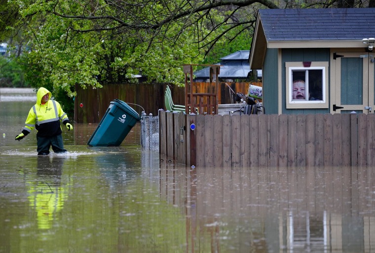
On Monday morning, millions woke up to flooding, and 9 million people were under flood watches across parts of Georgia and eastern Alabama.
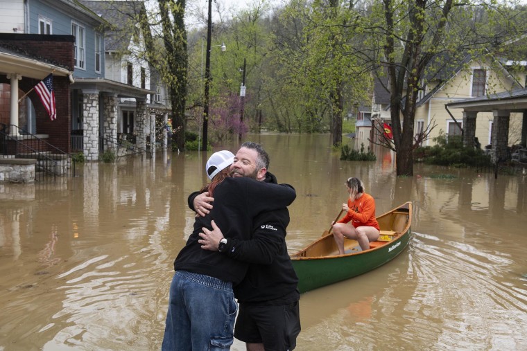
In Louisville, Kentucky, river levels rose 5 feet in just 24 hours. In Owensboro, Kentucky, a levee broke, sending water into fields. Meanwhile, in Dawson Springs, Kentucky, rising waters reached a substation, causing authorities to cut power.
Kentucky has been hit hard. In Anderson County, mandatory evacuations were issued for low-lying communities near the Kentucky River after the region got more than 7 inches of rain since Thursday and multiple feet of flooding. The local fire department said it rescued more than 40 people from the floods over the weekend.
Anderson County Assistant Fire Chief Chad Womack told NBC affiliate WLEX of Lexington some locals have "lost everything they’ve had" and called the flooding "one of those once-in-a-generation-type storms that you may never see again."
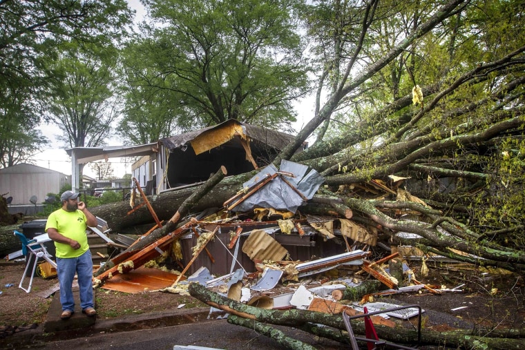
Since Wednesday, there have also been preliminary reports of 93 tornadoes, and crews are working around the clock to help communities clean up. Saturday also marked 10 consecutive days with a tornado — the earliest in the year the United States has hit that mark, according to storm prediction forecaster Evan Bentley.
Flooding still poses a major threat, as some rivers are expected to crest until midweek. NBC News' Al Roker forecasts that some of the worst flooding will be in the Arkansas, Mississippi, Tennessee and Ohio rivers.

As of Monday morning, 19 river locations were in major flood stages; 40 other river gauges are forecast to rise into major flood stages Monday.
The hardest-hit communities include Hardy, Arkansas; Columbus, Indiana; Dawson Springs, Kentucky; Mammoth Springs, Arkansas; and Frankfort, Kentucky.
Kentucky set a state record for the highest four-day rainfall. The Marshall County weather station, 4 miles north of Benton, got 15.59 inches of rain in the four days ending midnight Saturday.

On Monday, a low-pressure system moving from the southern mid-Atlantic to the Southeast will bring widespread showers and thunderstorms, creating a moderate to heavy rain threat for parts of southeast Virginia to the central Gulf Coast, the National Weather Service said.
The storm system will also create lighter rain across the Northeast and some light to moderate snow across parts of New England.
Storms were already charging through Georgia on Monday morning, with radar indicating tornadoes south of Atlanta and near Blakely.

Through Monday evening, 1 to 2 inches of rain with locally higher amounts of up to 3 inches may fall across Georgia, South Carolina and North Carolina.
The rain and flood threat will end by Monday night as the cold front moves offshore.
Meanwhile, a series of Pacific storms will bring unsettled weather to the Pacific Northwest and the northern Rockies through the midweek, bringing rain to coastal locations and snow to higher elevations.
