Rain chances today and Sunday; First Alert Day Monday

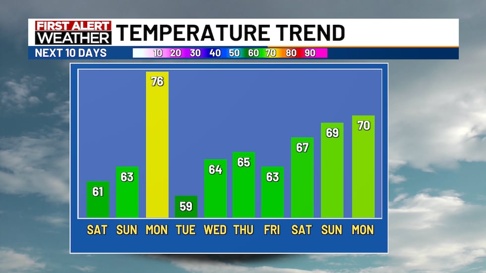
High temperatures will be in the 60s this weekend with 70s likely on Monday
Published: Apr. 25, 2025 at 8:40 AM CDT
Email This Link
Share on Pinterest
Share on LinkedIn

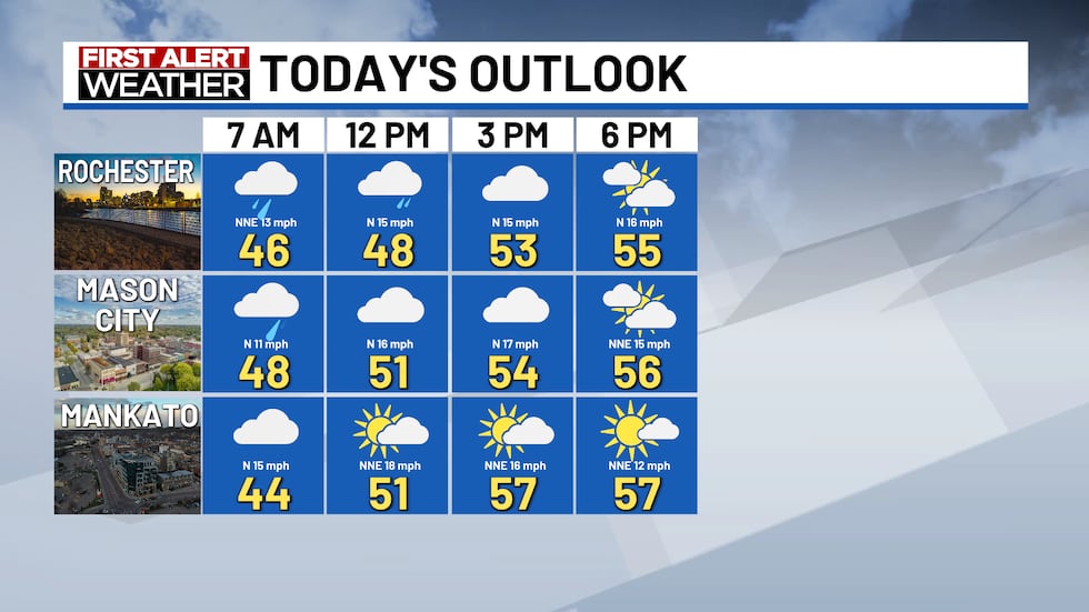
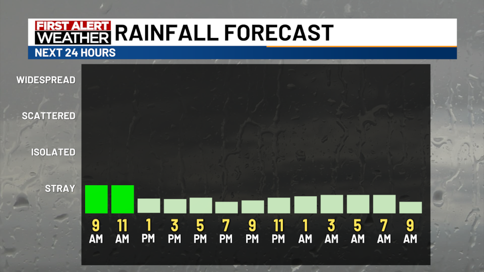
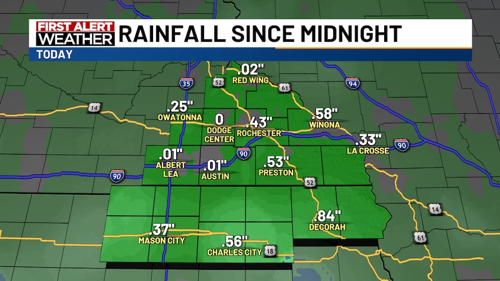
ROCHESTER, Minn. (KTTC) – Clouds and light rain will slowly clear off today as a large storm system pushes through the Upper Mississippi Valley. Expect light rain this morning with sprinkles tapering off in the early afternoon. High temperatures will be in the mid-50s, with a brisk northwest breeze this afternoon. A few glimpses of sunshine will be possible just before sunset as our cloud cover gradually moves out.

There will be a chance of light showers or sprinkles until early this afternoon. High temps...
There will be a chance of light showers or sprinkles until early this afternoon. High temps will be in the 50s.(KTTC)
A few stray showers or sprinkles will be possible until early afternoon.
A few stray showers or sprinkles will be possible until early afternoon.(KTTC)
Light to moderate rainfall overnight has led to some impressive rainfall totals in the area....
Light to moderate rainfall overnight has led to some impressive rainfall totals in the area. Through 9 AM, Rochester has measured nearly half an inch of rainfall from this storm system.(KTTC)

Under a clear sky tonight, temperatures will fall to the mid-30s, with light north winds.

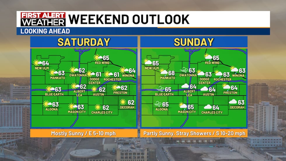
After a sunny and tranquil Saturday, a few showers will develop on Sunday with limited sunshine between those rain chances. High temperatures this weekend will be in the low 60s.

After a sunny and pleasant Saturday, a few showers will be possible on Sunday. High temps will...
After a sunny and pleasant Saturday, a few showers will be possible on Sunday. High temps will be in the 60s this weekend.(KTTC)
There will be chances of rain today and on Sunday. Strong to severe thunderstorms will be...
There will be chances of rain today and on Sunday. Strong to severe thunderstorms will be possible on Monday as a cold front moves through the region.(KTTC)

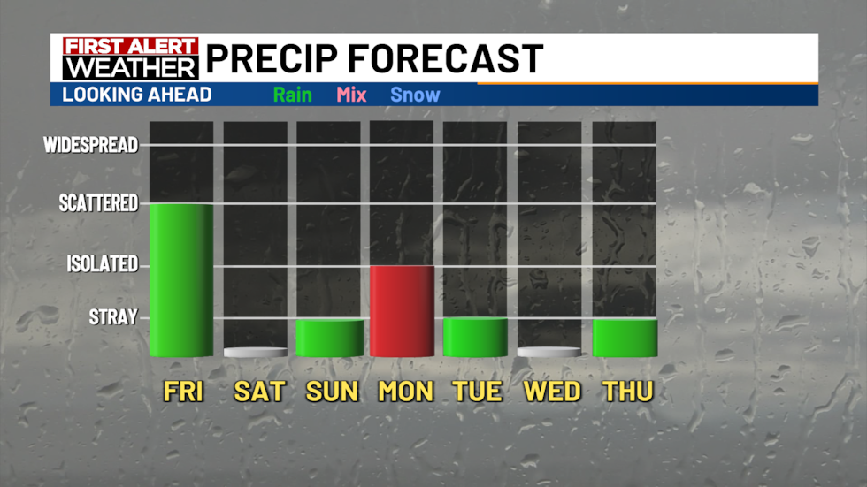
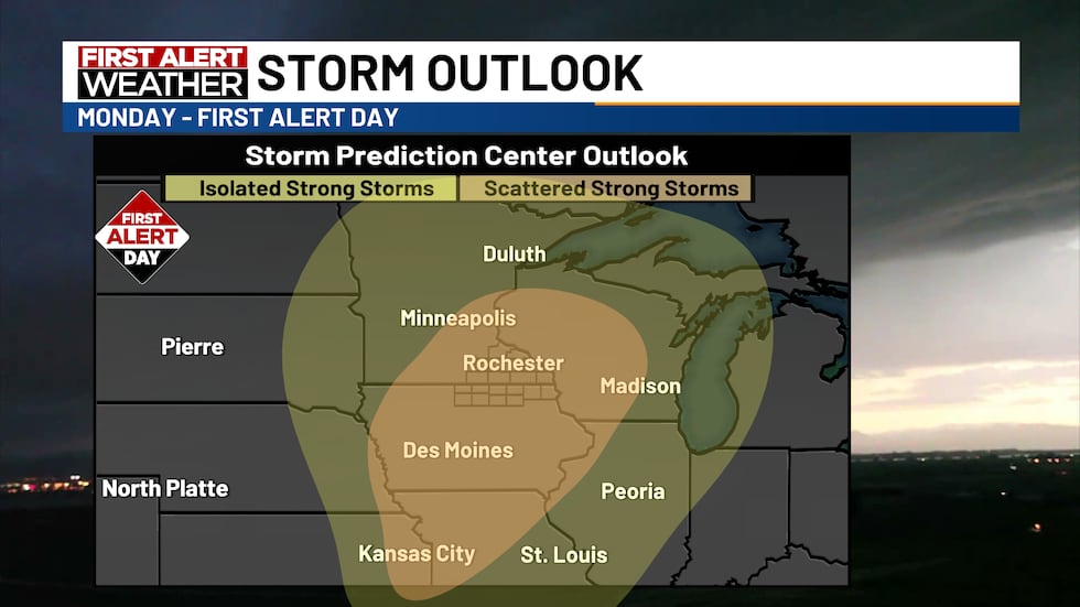
Monday will be a First Alert Day as strong south winds will work to pull in warm air, creating enough instability to prime the atmosphere for severe weather in the afternoon. High temperatures will be in the mid and upper 70s, with south winds reaching 40 miles per hour. The Storm Prediction Center has outlined the entire Upper Mississippi Valley for the threat of tornadoes, damaging winds, gusts, and large hail, and it’s a situation that bears watching closely over the next few days.

Strong to severe thunderstorms will be possible on Monday afternoon and evening.
Strong to severe thunderstorms will be possible on Monday afternoon and evening.(KTTC)
High temps will be in the 60s this weekend with strong to severe thunderstorms possible on...
High temps will be in the 60s this weekend with strong to severe thunderstorms possible on Monday.(KTTC)

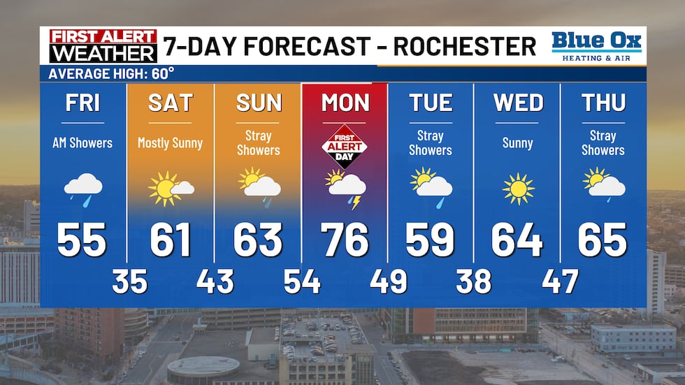
Behind Monday night’s cold front, temperatures will cool to the 50s on Tuesday with a few stray showers possible. High temperatures for the remainder of next week will be in the seasonably mild 60s heading toward the start of May later in the week.

High temps will be seasonably warm this weekend. After a windy and warm day next Monday,...
High temps will be seasonably warm this weekend. After a windy and warm day next Monday, expect readings in the 60s for most of next week.(KTTC)
@ted_schmidt

My one minute forecast for Friday, April 25, 2025. Rain showers will tape off in the midday hours today. Expect abundant sunshine on Saturday with a few spotty shower Sunday. Severe weather is a possibility on Monday with gusty winds and high temperatures in the 70s. #kttcwxm#weatherman#kttcwx#weather#tgif

♬ Gym Workout - Instrumental - Type Beat

Find stories like this and more in our apps.

close