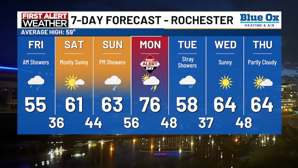
Thursday PM Showers; First Alert Day on Monday
Strong to severe storms are likely on Monday
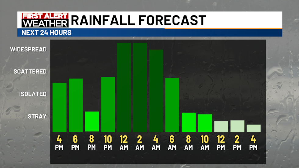
ROCHESTER, Minn. (KTTC) – We are rounding off Thursday on a rather gloomy note. Scattered showers are expected to move throughout southern Minnesota and northeast Iowa overnight into Friday morning. Rainfall will be on the lighter side, but we could see pockets of moderate rainfall in isolated spots. Rainfall totals will likely range to 0.25-0.75″ across the viewing area.
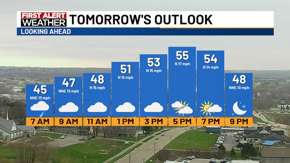
Overnight temperatures will drop into the mid to upper 40s for mild conditions. Winds will be sustained around 10 mph out of the northeast. Tomorrow we will be drying out from the overnight showers with highs reaching the 50s. Cloud coverage will decrease gradually throughout the day for mostly cloudy to partly cloudy skies in the late afternoon and early evening. Northern winds will be breezy around 10-15 mph.
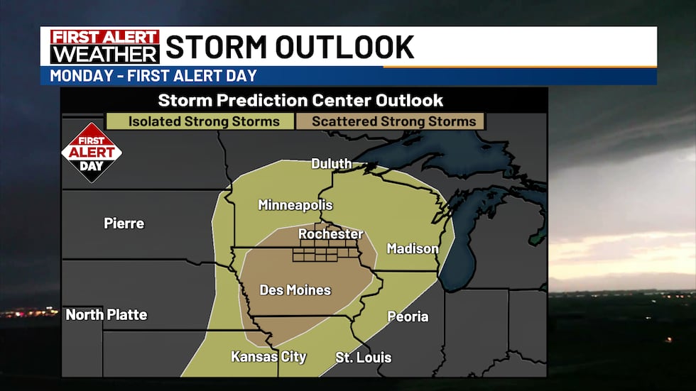
Shower and storm chances continue throughout much of the early next week, with stray to scattered chances. We are issuing a First Alert Day on Monday for strong to severe storms. The Storm Prediction Center (SPC) has upped our risk within the last 24 hours to a higher risk for strong to severe storms. Even though we are five days out, long-term model guidance supports the threat of strong to severe storms across our viewing area. We will keep you updated as we go through the next few days.
Throughout the week we will be trending in the 50s, 60s, and a brief stint in the 70s on Monday.
Find stories like this and more, in our apps.
Copyright 2025 KTTC. All rights reserved.


