Making a mosaic of the Sun
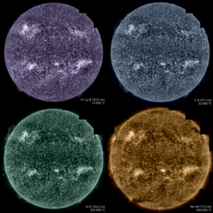
This animation shows how Solar Orbiter obtains its high-resolution full Sun views. While both the Extreme Ultraviolet Imager (EUI) and Polarimetric and Helioseismic Imager (PHI) instruments on the spacecraft are capable of imaging the entire Sun in a single shot, their high-resolution cameras only cover a small patch of the Sun at any one time.
To get a high-resolution view of the full solar disc, Solar Orbiter is first oriented to point to different regions across the Sun, usually in a 5 x 5 grid, with images taken at each pointing direction. These are then stitched together to create a much larger ‘mosaic’.
Shown here is how this was done on 9 March 2025. The animation shows the Sun as seen by EUI's Full Sun Imager. At each pointing direction, highlighted by the dark squares, the EUI instrument captured six images at high resolution and two wide-angle views. These 200 individual images were then combined to create the widest high-resolution image of the Sun yet. Combining multiple images at each pointing direction improves the brightness and sharpness of the final image.
The green-red grid overlaid on the Sun shows the solar latitude and longitude lines, with the blue (red) vertical line indicating the Sun's south (north) pole. The crossing point of the thick yellow lines is the midpoint of Earth's view. Meanwhile, Solar Orbiter was viewing the Sun from a south solar latitude of 11.4 degrees at around 77 million km from the Sun.
On the bottom left of the animation you can see the date and time (in UTC), the distance of the spacecraft to the centre of the Sun in astronomical units (1 AU = 150 million km), and the field of view of the EUI Full Sun Imager in solar radii (1 R☉ = 696 000 km).
Solar Orbiter is a space mission of international collaboration between ESA and NASA. The Extreme Ultraviolet Imager (EUI) instrument is led by the Royal Observatory of Belgium (ROB).
[Video description: On a black background, the Sun looks like a slowly rotating warm yellow sphere with a surface covered with glowing messy hair. Moving, bright yellow arcs extend from the Sun's surface, while other regions look dark. Overlaid on this image are red-green dashed lattitude-longitude lines and a set of solid yellow lines at 0° longitude and −7.2° latitude. A vertical blue line extends from the Sun's south pole, and a red line from the north pole. As time progresses, a dark square moves from the northwest of the Sun down to the southwest in five steps, then repeats this one step to the east until it has covered all of the Sun's disc in a 5 x 5 grid.]